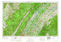
1964 Map of Chattanooga
USGS Topo · Published 1964About this map
Chattanooga serves as the industrial and transportation anchor for this 1964 regional overview, where the Tennessee River winds through a landscape of heavy industry and managed waterways. The map illustrates the massive scale of the Tennessee Valley Authority’s impact, featuring extensive reservoirs like Watts Bar Lake and Chickamauga Lake. Industrial and military footprints are prominent, including the Volunteer Ordnance Works near the city and the Atomic Energy Commission (Oak Ridge Area) to the northeast.
Find a feature on this map
117 named features on this map. Tap any name to fly to it.
Don’t see what you’re looking for? This feature index may not catch every label — zoom into the map to look around manually.
Map Details
Editions of this 1964 Chattanooga Map
This is the sole edition of this map. No revisions or reprints were ever made.
Other maps of this area

1886 · Dalton
USGS Topo · 1:125,000

1886 · Cleveland
USGS Topo · 1:125,000

1886 · Knoxville
USGS Topo · 1:125,000

1886 · Ringgold
USGS Topo · 1:125,000

1886 · Stevenson
USGS Topo · 1:125,000

1886 · Dahlonega
USGS Topo · 1:125,000

1887 · Kingston
USGS Topo · 1:125,000

1888 · Ellijay
USGS Topo · 1:125,000

1888 · Chattanooga
USGS Topo · 1:125,000

1888 · Scottsboro
USGS Topo · 1:125,000