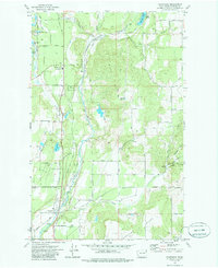
1973 Map of Chattaroy
USGS Topo · Published 1986About this map
Little Spokane River flows southward through this corner of Spokane County, providing the central corridor for both the Burlington Northern railroad and the early settlements of Milan and Chattaroy. The landscape transition is evident between the elevated Milan Hills and Orchard Bluff, with a dense network of local roads such as Milan Road and Chattaroy Road connecting these valley communities.
Find a feature on this map
67 named features on this map. Tap any name to fly to it.
Don’t see what you’re looking for? This feature index may not catch every label — zoom into the map to look around manually.
Map Details
Editions of this 1973 Chattaroy Map
2 editions found

Other maps of this area

1901 · Spokane
USGS Topo · 1:125,000

1936 · Newport
USGS Topo · 1:96,000

1942 · Newport
USGS Topo · 1:125,000

1943 · Mt Spokane
USGS Topo · 1:62,500

1949 · Deer Park
USGS Topo · 1:62,500

1950 · Mt Spokane
USGS Topo · 1:62,500

1951 · Deer Park
USGS Topo · 1:62,500

1955 · Spokane
USGS Topo · 1:250,000

1958 · Spokane
USGS Topo · 1:250,000

1958 · Sandpoint
USGS Topo · 1:250,000