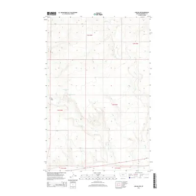
2014 Map of Chelsea NW
USGS Topo · Published 2014About this map
The high plains of the Wolf Point District are defined by the winding drainages of Chelsea Cr and Tule Cr as they cut through the Montana landscape. This 2014 survey captures a rural expanse of Roosevelt County where the transport network is anchored by Us-2 and Mt-13. For local history and genealogy researchers, the map provides precise locations for water sources such as 28N48E11DDAB01 Spring and 28N48E12CCCC01 Spring, as well as the crossing at Tule Creek Bridge. The landscape is structured by a grid of county roads, including CR-2052 and CR-2058, which connect isolated sections of the township and range system. This documentation offers a clear view of the area's physical geography before modern development or land-use changes could alter these traditional transit corridors.
Find a feature on this map
15 named features on this map. Tap any name to fly to it.
Don’t see what you’re looking for? This feature index may not catch every label — zoom into the map to look around manually.
Map Details
Editions of this 2014 Chelsea NW Map
This is the sole edition of this map. No revisions or reprints were ever made.
Other maps of this area

1910 · Cuskers
USGS Topo · 1:62,500

1912 · Chelsea
USGS Topo · 1:62,500

1915 · Tule Valley
USGS Topo · 1:62,500

1915 · Cuskers
USGS Topo · 1:62,500

1916 · Wolf Point
USGS Topo · 1:62,500

1954 · Wolf Point
USGS Topo · 1:250,000

1958 · Wolf Point
USGS Topo · 1:250,000

1972 · Chelsea SW
USGS Topo · 1:24,000

1972 · Chelsea
USGS Topo · 1:24,000

1972 · Macon
USGS Topo · 1:24,000