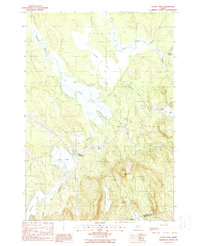
1988 Map of Chemo Pond
USGS Topo · Published 1988About this map
The low-lying wetlands of Chemo Bog dominate the northern landscape of this Penobscot County region, feeding directly into the expansive Chemo Pond. This water system is central to the local geography, with Blackman Stream and Great Works Stream draining the surrounding forests. Small clusters of settlement are concentrated at East Eddington and Clifton Corners, where the terrain begins to rise sharply toward the south. The transition from the boggy lowlands to the elevations of Pisgah Mountain and Blackcap illustrates the varied topography found on the border of the Penobscot and Hancock County line. In addition to the larger ponds, smaller water bodies like Snowshoe Pond and Davis Pond are tucked into the hills, connected by a network of seasonal snowmobile trails and woodland brooks including Sibley Brook.
Find a feature on this map
32 named features on this map. Tap any name to fly to it.
Don’t see what you’re looking for? This feature index may not catch every label — zoom into the map to look around manually.
Map Details
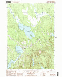
Editions of this 1988 Chemo Pond Map
2 editions found
Other maps of this area

1900 · Orland
USGS Topo · 1:62,500

1902 · Orono
USGS Topo · 1:62,500

1911 · Ellsworth
USGS Topo · 1:62,500

1929 · Great Pond
USGS Topo · 1:48,000

1932 · Great Pond
USGS Topo · 1:62,500

1940 · Ellsworth
USGS Topo · 1:62,500

1942 · Orland
USGS Topo · 1:62,500

1942 · Ellsworth
USGS Topo · 1:62,500

1944 · Orono
USGS Topo · 1:62,500

1946 · Orono
USGS Topo · 1:62,500