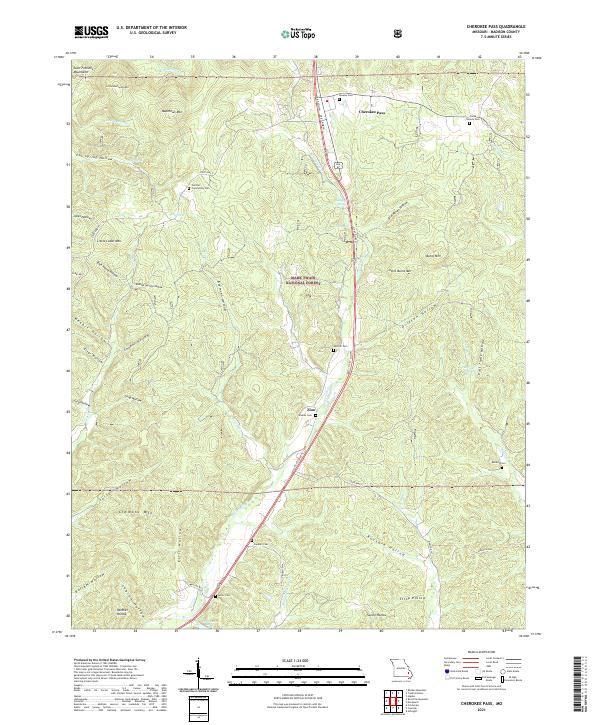
2021 Map of Cherokee Pass
USGS Topo · Published 2021About this map
The Saint Francois Mountains frame the northern reaches of this Madison County landscape, where the terrain transitions into the protected acreage of the Mark Twain National Forest. The community of Zion serves as a central point along the path of Twelvemile Cr, while the crossroads at Cherokee Pass marks the northern corridor. The area is defined by its deep hollows, such as Old Mines Hollow and Buzzard Hollow, reflecting a topography carved by numerous springs and creeks including Cold Spring and E Fork Big Cr. Genealogists will find a high density of small family and community burial grounds, from Central Community Cem in the west to the isolated Burnley Cem near the eastern boundary, suggesting a long history of rural settlement tied to the upland valleys and mountain gaps.
Find a feature on this map
64 named features on this map. Tap any name to fly to it.
Don’t see what you’re looking for? This feature index may not catch every label — zoom into the map to look around manually.
Map Details
Editions of this 2021 Cherokee Pass Map
This is the sole edition of this map. No revisions or reprints were ever made.
Other maps of this area

1910 · Higdon
USGS Topo · 1:62,500

1930 · Coldwater
USGS Topo · 1:62,500

1933 · Marquand
USGS Topo · 1:62,500

1938 · Marquand
USGS Topo · 1:62,500

1939 · Fredericktown
USGS Topo · 1:48,000

1947 · Fredericktown
USGS Topo · 1:62,500

1949 · Rolla
USGS Topo · 1:250,000

1949 · Coldwater
USGS Topo · 1:62,500

1950 · Fredericktown
USGS Topo · 1:62,500

1953 · Rolla
USGS Topo · 1:250,000