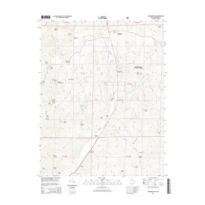
2015 Map of Cherokee Pass
USGS Topo · Published 2015About this map
Cherokee Pass and the surrounding highlands of the Mark Twain National Forest define this area of Madison County, Missouri. The landscape is heavily dissected by deep hollows and creek beds, notably Twelvemile Cr and Peters Cr, which wind through the township boundaries of T32N and T33N. The settlement patterns reflect a history of rural concentration at Central and Zion, with numerous family-named landmarks such as Little Matthews Mtn and Little Burns Mtn suggesting long-standing local ties to the land.
Find a feature on this map
72 named features on this map. Tap any name to fly to it.
Don’t see what you’re looking for? This feature index may not catch every label — zoom into the map to look around manually.
Map Details
Editions of this 2015 Cherokee Pass Map
This is the sole edition of this map. No revisions or reprints were ever made.
Other maps of this area

1910 · Higdon
USGS Topo · 1:62,500

1930 · Coldwater
USGS Topo · 1:62,500

1933 · Marquand
USGS Topo · 1:62,500

1938 · Marquand
USGS Topo · 1:62,500

1939 · Fredericktown
USGS Topo · 1:48,000

1947 · Fredericktown
USGS Topo · 1:62,500

1949 · Rolla
USGS Topo · 1:250,000

1949 · Coldwater
USGS Topo · 1:62,500

1950 · Fredericktown
USGS Topo · 1:62,500

1953 · Rolla
USGS Topo · 1:250,000