
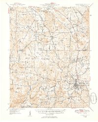
1950 Map of Fredericktown
USGS Topo · Published 1950About this map
Fredericktown serves as the focal point for this mid-century look at the southeastern Missouri mineral district, where the industrial footprint of the St Joseph Lead Mines and Catherine Mines defines the local economy. The landscape is characterized by the descent from the Saint Francois Mountains, with the St Francis River and the Little St Francis River cutting through a terrain marked by numerous knobs and ridges. This survey illustrates a dense network of rural infrastructure, including localized settlements like Knob Lick and Slabtown, and a high concentration of country schools such as German Sch and Piney Sch.
Find a feature on this map
106 named features on this map. Tap any name to fly to it.
Don’t see what you’re looking for? This feature index may not catch every label — zoom into the map to look around manually.
Map Details
Editions of this 1950 Fredericktown Map
2 editions found
Other maps of this area

1904 · Farmington
USGS Topo · 1:62,500

1905 · Bonneterre
USGS Topo · 1:62,500

1906 · Farmington
USGS Topo · 1:62,500

1907 · Weingarten
USGS Topo · 1:62,500

1909 · Weingarten
USGS Topo · 1:62,500

1910 · Higdon
USGS Topo · 1:62,500

1926 · Des Arc
USGS Topo · 1:62,500

1929 · Des Arc
USGS Topo · 1:62,500

1930 · Coldwater
USGS Topo · 1:62,500

1933 · Marquand
USGS Topo · 1:62,500