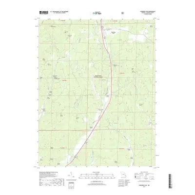
2017 Map of Cherokee Pass
USGS Topo · Published 2017About this map
Cherokee Pass serves as a central hub in this Madison County landscape, situated along a prominent north-south transit corridor flanked by the dense woodlands of the Mark Twain National Forest. The map reveals a deeply etched topography of ridges and hollows, such as Old Mines Hollow and Wildcat Springs Hollow, which reflect the region's historical ties to small-scale extraction and spring-fed settlements. Small rural communities like Zion are identified alongside a network of family cemeteries, including Revelle Cem and Antioch Cem, providing essential markers for genealogical research in the Missouri Ozarks. Water plays a vital role in the geography here, with the headwaters of Twelvemile Cr and Middle Fork Big Cr carving through the terrain near landmarks like Little Matthews Mtn and Whitehurst Lake.
Find a feature on this map
59 named features on this map. Tap any name to fly to it.
Don’t see what you’re looking for? This feature index may not catch every label — zoom into the map to look around manually.
Map Details
Editions of this 2017 Cherokee Pass Map
This is the sole edition of this map. No revisions or reprints were ever made.
Other maps of this area

1910 · Higdon
USGS Topo · 1:62,500

1930 · Coldwater
USGS Topo · 1:62,500

1933 · Marquand
USGS Topo · 1:62,500

1938 · Marquand
USGS Topo · 1:62,500

1939 · Fredericktown
USGS Topo · 1:48,000

1947 · Fredericktown
USGS Topo · 1:62,500

1949 · Rolla
USGS Topo · 1:250,000

1949 · Coldwater
USGS Topo · 1:62,500

1950 · Fredericktown
USGS Topo · 1:62,500

1953 · Rolla
USGS Topo · 1:250,000