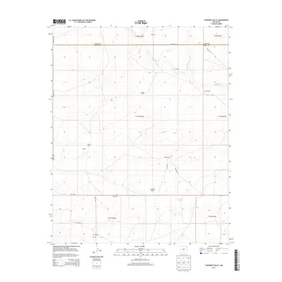
2013 Map of Cherokee Valley
USGS Topo · Published 2013About this map
Cherokee Valley defines this high plains landscape along the border of Union and Quay Counties, where a sparse network of ranches and windmills marks the local ranching economy. The topography is dominated by the drainages of Minnesota Cr and its N Fork Minnesota Cr in the north, while the southern portion features the essential water resource of Vandergrift Tank. Genealogists and historians will find interest in the scattered family-named locations such as Kaufman Ranch, Burks Ranch, and Johnson Ranch, which reflect the localized settlement patterns of the early 21st century. The Cherokee Valley Cem remains a primary landmark for local history, situated near Quay Road 96, which serves as a major east-west artery through this corner of New Mexico.
Find a feature on this map
33 named features on this map. Tap any name to fly to it.
Don’t see what you’re looking for? This feature index may not catch every label — zoom into the map to look around manually.
Map Details
Editions of this 2013 Cherokee Valley Map
This is the sole edition of this map. No revisions or reprints were ever made.
Other maps of this area

1954 · Tucumcari
USGS Topo · 1:250,000

1958 · Tucumcari
USGS Topo · 1:250,000

1966 · Rosebud
USGS Topo · 1:24,000

1966 · Ione
USGS Topo · 1:24,000

1966 · Cherokee Valley
USGS Topo · 1:24,000

1966 · Lockney
USGS Topo · 1:24,000

1966 · Mc Carty Ranch
USGS Topo · 1:24,000

1966 · Mc Cloy Ranch
USGS Topo · 1:24,000

1971 · Kerlin Hill
USGS Topo · 1:24,000

1971 · Centerville Corner
USGS Topo · 1:24,000