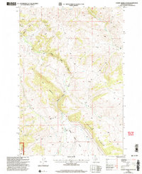
2000 Map of Cherry Creek Canyon
USGS Topo · Published 2005About this map
Gallatin National Forest encompasses much of this high-elevation landscape, where the Upper Cherry Creek Basin funnels water through narrow corridors like Cherry Creek Canyon. The map reveals a working mountain landscape centered on remote outposts like the Butler Ranch, Home Ranch, and a seasonal Cow Camp. These sites are linked by early water management infrastructure, including the Butler Ditch, which follows the contours of the steep slopes.
Find a feature on this map
28 named features on this map. Tap any name to fly to it.
Don’t see what you’re looking for? This feature index may not catch every label — zoom into the map to look around manually.
Map Details
Editions of this 2000 Cherry Creek Canyon Map
This is the sole edition of this map. No revisions or reprints were ever made.
Other maps of this area

1888 · Three Forks
USGS Topo · 1:250,000

1894 · Three Forks
USGS Topo · 1:250,000

1895 · Three Forks
USGS Topo · 1:250,000

1947 · Bozeman
USGS Topo · 1:250,000

1948 · Bozeman
USGS Topo · 1:250,000

1949 · Anceney
USGS Topo · 1:62,500

1949 · Ennis
USGS Topo · 1:62,500

1949 · Norris
USGS Topo · 1:62,500

1950 · Spanish Peaks
USGS Topo · 1:62,500

1951 · Norris
USGS Topo · 1:62,500