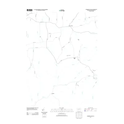
2013 Map of Cherry Flats
USGS Topo · Published 2013About this map
Babb Cr and its many tributaries, including Nickel Run and Sand Run, define the drainage patterns of this Tioga County landscape. The settlement of Cherry Flats occupies the northern reaches of the quadrangle, while Maple Hill sits centrally near the Maple Hill Fire Tower. The road network consists largely of local connectors like Cherry Flats Rd and Haverly Hill Rd, reflecting a rural area where transportation follows the natural contours of the valley floors and ridgelines. In the southern portion, the small settlement of Landrus is situated along the banks of Babb Cr near the confluence with Lick Cr. This survey captures the region's character as a network of small upland communities and seasonal drainage ways such as Silver Run and Red Run.
Find a feature on this map
49 named features on this map. Tap any name to fly to it.
Don’t see what you’re looking for? This feature index may not catch every label — zoom into the map to look around manually.
Map Details
Editions of this 2013 Cherry Flats Map
This is the sole edition of this map. No revisions or reprints were ever made.
Other maps of this area

1900 · Tioga
USGS Topo · 1:62,500

1900 · Elkland
USGS Topo · 1:62,500

1902 · Tioga
USGS Topo · 1:62,500

1925 · Blossburg
USGS Topo · 1:62,500

1927 · Blossburg
USGS Topo · 1:62,500

1944 · Blossburg
USGS Topo · 1:62,500

1946 · Antrim
USGS Topo · 1:62,500

1946 · Antrim
USGS Topo · 1:24,000

1946 · Morris
USGS Topo · 1:24,000

1948 · Antrim
USGS Topo · 1:24,000
Featured Places
- Morris Township, PA
- Duncan Township, PA
- Bloss Township, PA
- Cherry Flats, Covington Township
- Maple Hill, Bloss Township