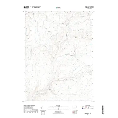
2019 Map of Cherry Flats
USGS Topo · Published 2019About this map
Cherry Flats and the nearby Landrus settlement anchor this study of north-central Pennsylvania's dissected plateau. The landscape is defined by a dense network of watercourses, including Babb Cr, Nickel Run, and Rock Run, which have carved deep valleys through high points like Maple Hill and depressions such as Copp Hollow. This hydrology has long dictated the layout of the local transport network, with routes like Steam Mill Rd and Swede Hill Rd following the natural contours of the terrain.
Find a feature on this map
49 named features on this map. Tap any name to fly to it.
Don’t see what you’re looking for? This feature index may not catch every label — zoom into the map to look around manually.
Map Details
Editions of this 2019 Cherry Flats Map
This is the sole edition of this map. No revisions or reprints were ever made.
Other maps of this area

1900 · Tioga
USGS Topo · 1:62,500

1900 · Elkland
USGS Topo · 1:62,500

1902 · Tioga
USGS Topo · 1:62,500

1925 · Blossburg
USGS Topo · 1:62,500

1927 · Blossburg
USGS Topo · 1:62,500

1944 · Blossburg
USGS Topo · 1:62,500

1946 · Antrim
USGS Topo · 1:62,500

1946 · Antrim
USGS Topo · 1:24,000

1946 · Morris
USGS Topo · 1:24,000

1948 · Antrim
USGS Topo · 1:24,000
Featured Places
- Morris Township, PA
- Duncan Township, PA
- Bloss Township, PA
- Cherry Flats, Covington Township
- Maple Hill, Bloss Township