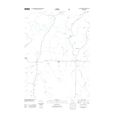
2013 Map of Cherry Grove
USGS Topo · Published 2013About this map
The Allegheny Fish Hatchery sits along the upper reaches of Minister Cr, serving as a central landmark in this heavily forested portion of Warren County. In the early 2010s, the settlement pattern remained concentrated around Cherry Grove and Vandergriff Corners, while the surrounding terrain was defined by an intricate network of forest roads and drainage runs. Historical transit and timber legacy is evidenced by Dunham Siding near the western edge. The landscape is dotted with water sources like Hermit Spring and Rams Horn Spring, which feed into various tributaries including the W Br Tionesta Cr and Middle Hickory Cr. This topographic study provides a detailed view of the watershed management and rural infrastructure, from the Chapman Dam Reservoir in the north down to the headwaters of Fools Cr and Porcupine Run in the south.
Find a feature on this map
37 named features on this map. Tap any name to fly to it.
Don’t see what you’re looking for? This feature index may not catch every label — zoom into the map to look around manually.
Map Details
Editions of this 2013 Cherry Grove Map
This is the sole edition of this map. No revisions or reprints were ever made.
Other maps of this area

1906 · Warren
USGS Topo · 1:62,500

1907 · Warren
USGS Topo · 1:62,500

1908 · Warren
USGS Topo · 1:62,500

1926 · Youngsville
USGS Topo · 1:62,500

1927 · Tidioute
USGS Topo · 1:48,000

1929 · Youngsville
USGS Topo · 1:62,500

1930 · Tidioute
USGS Topo · 1:62,500

1935 · Sheffield
USGS Topo · 1:48,000

1941 · Sheffield
USGS Topo · 1:62,500

1943 · Youngsville
USGS Topo · 1:62,500
Featured Places
- Cherry Grove Township, PA
- Watson Township, PA
- Howe Township, PA
- Kingsley Township, PA
- Hickory Township, PA