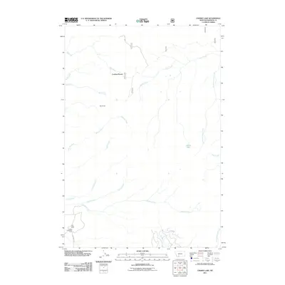
2011 Map of Cherry Lake
USGS Topo · Published 2011About this map
Cowboys Heaven and the high drainage basins of Madison County define this mountain landscape during the early 21st century. The map centers on the intricate network of alpine tributaries feeding into Cherry Creek and the South Fork Cherry Creek, including Fall Creek and Saint Joe Creek. The presence of Jack Creek Ranch and the Jumping Horse Stock Ranch in the southwestern corner indicates the enduring role of cattle and stock ranching in this high-elevation terrain. Prominent landmarks such as Red Knob and Cherry Lake provide key navigational points for understanding the area's hydrology. The sparse road network, primarily represented by E Entrance Rd, suggests a remote area where access is largely dictated by natural drainage lines and rugged topography.
Find a feature on this map
19 named features on this map. Tap any name to fly to it.
Don’t see what you’re looking for? This feature index may not catch every label — zoom into the map to look around manually.
Map Details
Editions of this 2011 Cherry Lake Map
This is the sole edition of this map. No revisions or reprints were ever made.
Other maps of this area

1888 · Three Forks
USGS Topo · 1:250,000

1894 · Three Forks
USGS Topo · 1:250,000

1895 · Three Forks
USGS Topo · 1:250,000

1947 · Bozeman
USGS Topo · 1:250,000

1948 · Bozeman
USGS Topo · 1:250,000

1949 · Anceney
USGS Topo · 1:62,500

1949 · Ennis
USGS Topo · 1:62,500

1949 · Norris
USGS Topo · 1:62,500

1950 · Spanish Peaks
USGS Topo · 1:62,500

1951 · Norris
USGS Topo · 1:62,500