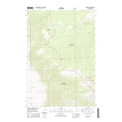
2017 Map of Cherry Lake
USGS Topo · Published 2017About this map
Cowboys Heaven sits atop the high terrain of the Madison Range in this modern topographic survey. The landscape is defined by the boundary between the Gallatin National Forest and Beaverhead National Forest, showing a network of high-altitude drainages and ridges. Water flows from numerous sources such as Fuller Spring Cr and Saint Joe Cr, while names like Placer Cr and Alder Cr suggest the area's history of mineral prospecting. The survey captures various hydrological features including the Jack Cr Ditch and the secluded Cherry Lake. Significant landmarks like Red Knob provide orientation across the remote backcountry. This map is essential for understanding the late-2010s trail and drainage patterns of these protected Montana wilderness areas, including the t4s r1e and t5s r2e township divisions.
Find a feature on this map
26 named features on this map. Tap any name to fly to it.
Don’t see what you’re looking for? This feature index may not catch every label — zoom into the map to look around manually.
Map Details
Editions of this 2017 Cherry Lake Map
This is the sole edition of this map. No revisions or reprints were ever made.
Other maps of this area

1888 · Three Forks
USGS Topo · 1:250,000

1894 · Three Forks
USGS Topo · 1:250,000

1895 · Three Forks
USGS Topo · 1:250,000

1947 · Bozeman
USGS Topo · 1:250,000

1948 · Bozeman
USGS Topo · 1:250,000

1949 · Anceney
USGS Topo · 1:62,500

1949 · Ennis
USGS Topo · 1:62,500

1949 · Norris
USGS Topo · 1:62,500

1950 · Spanish Peaks
USGS Topo · 1:62,500

1951 · Norris
USGS Topo · 1:62,500