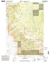
1997 Map of Cherry Lake
USGS Topo · Published 2002About this map
The Lee Metcalf Wilderness defines this section of the Madison Range, where the high-altitude drainage of Cherry Creek provides the primary hydrological structure. This 1997 revision by the Forest Service illustrates a complex intersection of administrative boundaries, including the Gallatin National Forest and the Beaverhead National Forest. While largely comprised of steep slopes and peaks like Anceney and Red Knob, the map documents localized human presence at the Cherry Creek Ranger Station and the Jack Creek Ranch.
Find a feature on this map
26 named features on this map. Tap any name to fly to it.
Don’t see what you’re looking for? This feature index may not catch every label — zoom into the map to look around manually.
Map Details
Editions of this 1997 Cherry Lake Map
This is the sole edition of this map. No revisions or reprints were ever made.
Other maps of this area

1888 · Three Forks
USGS Topo · 1:250,000

1894 · Three Forks
USGS Topo · 1:250,000

1895 · Three Forks
USGS Topo · 1:250,000

1947 · Bozeman
USGS Topo · 1:250,000

1948 · Bozeman
USGS Topo · 1:250,000

1949 · Anceney
USGS Topo · 1:62,500

1949 · Ennis
USGS Topo · 1:62,500

1949 · Norris
USGS Topo · 1:62,500

1950 · Spanish Peaks
USGS Topo · 1:62,500

1951 · Norris
USGS Topo · 1:62,500