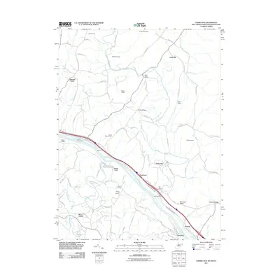
2011 Map of Cherry Run
USGS Topo · Published 2011About this map
The Potomac River corridor south of Yeakle Mill defines this landscape, where the historical infrastructure of the Chesapeake and Ohio Canal and the former Western Maryland Rail Tri parallel the riverbank. This 2011 survey documents a transition of the old canal into a modern recreational space, featuring the Licking Creek Aqueduct and Little Pool Campground. The map is particularly valuable for genealogists, detailing numerous burial grounds including Stone Bridge Cemetery, Orchard Ridge Cemetery, and Bethel Cemetery. Small settlements and rural community hubs like Millstone, Sleepy Creek, and Ernstville are shown alongside essential landmarks like the Sleepy Creek Post Office, providing a clear view of the area's social and transport geography.
Find a feature on this map
86 named features on this map. Tap any name to fly to it.
Don’t see what you’re looking for? This feature index may not catch every label — zoom into the map to look around manually.
Map Details
Editions of this 2011 Cherry Run Map
This is the sole edition of this map. No revisions or reprints were ever made.
Other maps of this area

1899 · Hancock
USGS Topo · 1:62,500

1900 · Mercersburg
USGS Topo · 1:62,500

1901 · Hancock
USGS Topo · 1:62,500

1902 · Mercersburg
USGS Topo · 1:62,500

1912 · Williamsport
USGS Topo · 1:62,500

1925 · Needmore
USGS Topo · 1:48,000

1935 · Needmore
USGS Topo · 1:62,500

1939 · Needmore
USGS Topo · 1:62,500

1942 · Hagerstown
USGS Topo · 1:125,000

1943 · Hagerstown
USGS Topo · 1:125,000