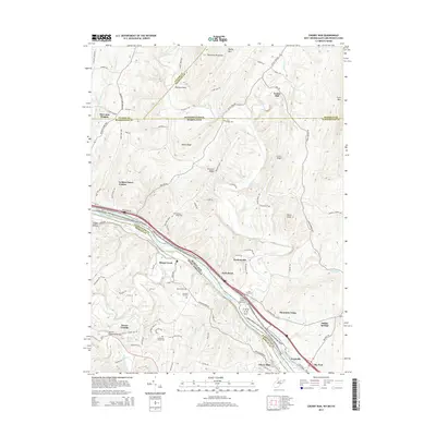
2014 Map of Cherry Run
USGS Topo · Published 2014About this map
The Potomac River carves a winding path through the borderlands of Pennsylvania, Maryland, and West Virginia, anchoring a landscape shaped by transportation history. The Chesapeake and Ohio Canal follows the river's northern bank, marked by the engineering legacy of the Licking Creek Aqueduct. Settlement patterns on this 2014 survey reflect both historic agricultural roots and modern developments, with established locations like Ernstville and Pecktonville appearing alongside newer residential areas such as Mountain Vistas and Golden Fleece Estates. Local history is preserved in numerous burial grounds, including the Stone Bridge Cem and Chestnut Grove Cem, while the northern reaches are dominated by the terrain of Tuscarora Mountain and Keefer Mtn. The persistence of early industry is noted at Yeakle Mill on the banks of Little Cove Cr, providing a clear record of the region's long-standing water-powered economy.
Find a feature on this map
106 named features on this map. Tap any name to fly to it.
Don’t see what you’re looking for? This feature index may not catch every label — zoom into the map to look around manually.
Map Details
Editions of this 2014 Cherry Run Map
This is the sole edition of this map. No revisions or reprints were ever made.
Other maps of this area

1899 · Hancock
USGS Topo · 1:62,500

1900 · Mercersburg
USGS Topo · 1:62,500

1901 · Hancock
USGS Topo · 1:62,500

1902 · Mercersburg
USGS Topo · 1:62,500

1912 · Williamsport
USGS Topo · 1:62,500

1925 · Needmore
USGS Topo · 1:48,000

1935 · Needmore
USGS Topo · 1:62,500

1939 · Needmore
USGS Topo · 1:62,500

1942 · Hagerstown
USGS Topo · 1:125,000

1943 · Hagerstown
USGS Topo · 1:125,000