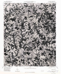
1976 Map of Cherryville
USGS Topo · Published 1978About this map
Cherryville anchors the southeastern corner of this mid-1970s orthophotograph, where the dense grid of residential streets and commercial buildings meets the surrounding agricultural landscape. Unlike traditional line-drawn maps, this survey, produced by the Geological Survey and the Department of Natural and Economic Resources, uses aerial photography to reveal the fine-grained texture of Piedmont farming. A mosaic of cultivated fields and wooded patches defines the terrain, punctuated by small rural hubs such as Fallston to the west and Baker Crossroads to the south. Further north, the smaller settlements of Flay and Dora sit at the intersection of local roads. This photographic record provides a clear look at land use patterns and property boundaries as they existed during the late 1970s, making it a valuable resource for tracing changes in the Gaston and Cleveland County borderlands.
Find a feature on this map
5 named features on this map. Tap any name to fly to it.
Don’t see what you’re looking for? This feature index may not catch every label — zoom into the map to look around manually.
Map Details
Editions of this 1976 Cherryville Map
This is the sole edition of this map. No revisions or reprints were ever made.
Other maps of this area

1895 · Hickory
USGS Topo · 1:125,000

1905 · Morganton
USGS Topo · 1:125,000

1909 · Lincolnton
USGS Topo · 1:62,500

1911 · Lincolnton
USGS Topo · 1:62,500

1950 · Shelby
USGS Topo · 1:62,500

1953 · Charlotte
USGS Topo · 1:250,000

1954 · Charlotte
USGS Topo · 1:250,000

1956 · Casar
USGS Topo · 1:24,000

1960 · Charlotte
USGS Topo · 1:250,000

1962 · Charlotte
USGS Topo · 1:250,000