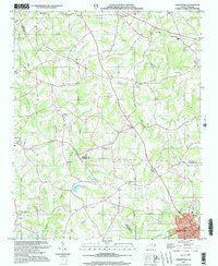
2002 Map of Cherryville
USGS Topo · Published 2003About this map
Cherryville anchors the southeastern corner of this map, appearing at a time of established local growth near the borders of Gaston, Lincoln, and Cleveland counties. The landscape is defined by the headwaters of several key Piedmont waterways, including the winding Buffalo Creek and the Muddy Fork, which historically supported the region's agricultural and early industrial development. Evidence of this rural economy is preserved in the location of the Beam Mill on the western edge of the sheet.
Find a feature on this map
48 named features on this map. Tap any name to fly to it.
Don’t see what you’re looking for? This feature index may not catch every label — zoom into the map to look around manually.
Map Details
Editions of this 2002 Cherryville Map
This is the sole edition of this map. No revisions or reprints were ever made.
Other maps of this area

1895 · Hickory
USGS Topo · 1:125,000

1905 · Morganton
USGS Topo · 1:125,000

1909 · Lincolnton
USGS Topo · 1:62,500

1911 · Lincolnton
USGS Topo · 1:62,500

1950 · Shelby
USGS Topo · 1:62,500

1953 · Charlotte
USGS Topo · 1:250,000

1954 · Charlotte
USGS Topo · 1:250,000

1956 · Casar
USGS Topo · 1:24,000

1960 · Charlotte
USGS Topo · 1:250,000

1962 · Charlotte
USGS Topo · 1:250,000