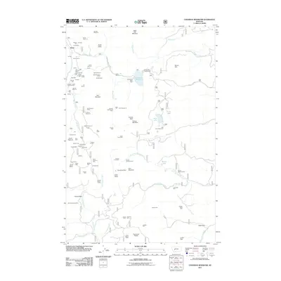
2011 Map of Chessman Reservoir
USGS Topo · Published 2011About this map
The mountain settlement of Rimini serves as a focal point for this landscape, which is heavily marked by its history of extraction. Dozens of named mines and diggings, such as Lexington, Bunker Hill, and Rob Roy, are clustered along the slopes of Red Mountain and the banks of Beaver Creek. This density of mining claims suggests a peak era of prospecting that shaped the local geography long before the contemporary recreational use of the land. In the eastern portion of the map, the terrain shifts toward water management and public access, anchored by the Chessman Reservoir and its associated infrastructure, including the Chessman Main Dam. High-elevation meadows and plateaus like Black Hall Meadows and the Occidental Plateau provide a sense of the varied alpine environment, while the presence of the Park Lake Campground near Park Lake indicates the transition of the area into a destination for forest recreation and wilderness exploration.
Find a feature on this map
105 named features on this map. Tap any name to fly to it.
Don’t see what you’re looking for? This feature index may not catch every label — zoom into the map to look around manually.
Map Details
Editions of this 2011 Chessman Reservoir Map
This is the sole edition of this map. No revisions or reprints were ever made.
Other maps of this area

1889 · Helena
USGS Topo · 1:250,000

1893 · Helena
USGS Topo · 1:250,000

1899 · Boulder
USGS Topo · 1:125,000

1899 · Helena
USGS Topo · 1:62,500

1899 · Helena
USGS Topo · 1:250,000

1903 · Helena
USGS Topo · 1:250,000

1947 · Butte
USGS Topo · 1:250,000

1950 · Jefferson City
USGS Topo · 1:62,500

1950 · Helena
USGS Topo · 1:62,500

1954 · Basin
USGS Topo · 1:62,500