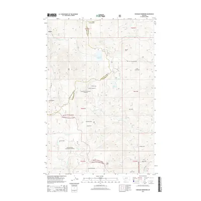
2014 Map of Chessman Reservoir
USGS Topo · Published 2014About this map
Rimini sits at the northern edge of this high-elevation mountain terrain where the boundaries of Helena National Forest and Deerlodge National Forest converge. The landscape is defined by the Continental Divide, crossing through the Occidental Plateau and past Lava Mtn. Historically significant for mining, the area includes the Gould Diggings and numerous gulches such as Lump Gulch and Roe Gulch that once saw intense prospecting activity. Water management is central to the area, with the Chessman Reservoir and high-mountain basins like Cataract Basin feeding the complex drainage networks of Tenmile Cr and Quartz Cr. Small openings in the dense timber, such as Frohner Meadows and Black Hall Meadows, provide a glimpse into the alpine meadow systems that supported early mountain life and grazing.
Find a feature on this map
46 named features on this map. Tap any name to fly to it.
Don’t see what you’re looking for? This feature index may not catch every label — zoom into the map to look around manually.
Map Details
Editions of this 2014 Chessman Reservoir Map
This is the sole edition of this map. No revisions or reprints were ever made.
Other maps of this area

1889 · Helena
USGS Topo · 1:250,000

1893 · Helena
USGS Topo · 1:250,000

1899 · Boulder
USGS Topo · 1:125,000

1899 · Helena
USGS Topo · 1:62,500

1899 · Helena
USGS Topo · 1:250,000

1903 · Helena
USGS Topo · 1:250,000

1947 · Butte
USGS Topo · 1:250,000

1950 · Jefferson City
USGS Topo · 1:62,500

1950 · Helena
USGS Topo · 1:62,500

1954 · Basin
USGS Topo · 1:62,500