
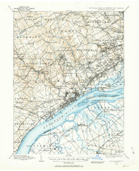
1894 Map of Chester
USGS Topo · Published 1954About this map
Media and Swarthmore serve as central hubs in this late nineteenth-century survey of the Pennsylvania-New Jersey borderlands. The landscape is defined by the industrial activity along the tributaries of the Delaware River, where numerous operations like Sycamore Mills, Lenni Mills, and Ivy Mills were established near the winding paths of Crum Creek and Darby Creek. The area shows a transition from the agricultural roots of Newtown Square and Edgemont toward the suburban growth near Lansdowne and Upper Darby.
Find a feature on this map
180 named features on this map. Tap any name to fly to it.
Don’t see what you’re looking for? This feature index may not catch every label — zoom into the map to look around manually.
Map Details
Editions of this 1894 Chester Map
2 editions found
Other maps of this area

1890 · Salem
USGS Topo · 1:62,500

1890 · Glassboro
USGS Topo · 1:62,500

1891 · Philadelphia
USGS Topo · 1:62,500

1893 · Germantown
USGS Topo · 1:62,500

1894 · Philadelphia
USGS Topo · 1:62,500

1894 · Norristown
USGS Topo · 1:62,500

1894 · Germantown
USGS Topo · 1:62,500

1895 · Norristown
USGS Topo · 1:62,500

1896 · Germantown
USGS Topo · 1:62,500

1896 · Philadelphia
USGS Topo · 1:62,500