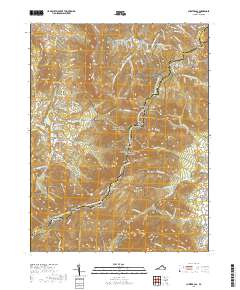
2019 Map of Chester Gap
USGS Topo · Published 2019About this map
The high ridges of the Blue Ridge Mountains dominate this 2019 survey, where the Shenandoah National Park boundary follows the winding path of Skyline Drive. The area is defined by its deep gaps and hollows, such as Harmony Hollow and Hickerson Hollow, which channel water into Gooney Run and Happy Cr. Long-established settlements like Browntown and Glen Echo sit in the lower elevations of the Page Valley, while the Appalachian National Scenic Trail traverses the crests of Compton Peak and Mt Marshall. This topographic study captures a landscape of extreme vertical relief, including the dramatic rocky features of Big Devils Stairs and the secluded Williams Cem. The map illustrates the persistent intersection of recreation and small-town Virginia life along the county lines of Warren, Fauquier, and Rappahannock.
Find a feature on this map
97 named features on this map. Tap any name to fly to it.
Don’t see what you’re looking for? This feature index may not catch every label — zoom into the map to look around manually.
Map Details
Editions of this 2019 Chester Gap Map
This is the sole edition of this map. No revisions or reprints were ever made.
Other maps of this area

1893 · Luray
USGS Topo · 1:125,000

1905 · Luray
USGS Topo · 1:125,000

1929 · Stony Man
USGS Topo · 1:48,000

1933 · Stony Man
USGS Topo · 1:62,500

1939 · Front Royal
USGS Topo · 1:48,000

1944 · Front Royal
USGS Topo · 1:62,500

1947 · Strasburg
USGS Topo · 1:62,500

1949 · Charlottesville
USGS Topo · 1:250,000

1950 · Strasburg
USGS Topo · 1:62,500

1956 · Charlottesville
USGS Topo · 1:250,000
Featured Places
- Chester Gap, VA
- Shenandoah Homesteads Project, VA
- Glen Echo, VA
- Browntown, VA
- Skyline View Mobile Home Park, VA