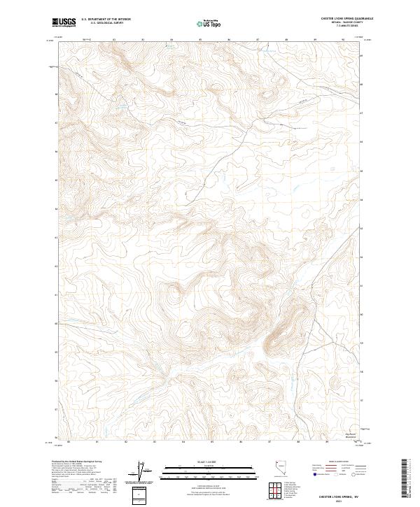
2021 Map of Chester Lyons Spring
USGS Topo · Published 2021About this map
The Hog Ranch Mountains anchor the southern reaches of this corner of Washoe County, where high-desert hydrology defines the sparse human geography. Named water sources such as Chester Lyons Spring, Findman Spring, and Gillam Spring are critical landmarks in a landscape otherwise marked by ephemeral drainages like Cottonwood Cr and Jims Cr. The infrastructure is minimal, centered primarily on the winding path of Chester Rd and C R 34, which provide the primary access through this rangeland. The map illustrates a classic Great Basin pattern where settlement is dictated by the presence of water, with the terrain falling away from the mountain slopes toward Grass Valley Cr.
Find a feature on this map
15 named features on this map. Tap any name to fly to it.
Don’t see what you’re looking for? This feature index may not catch every label — zoom into the map to look around manually.
Map Details
Editions of this 2021 Chester Lyons Spring Map
This is the sole edition of this map. No revisions or reprints were ever made.
Other maps of this area

1889 · Long Valley
USGS Topo · 1:250,000

1954 · Vya
USGS Topo · 1:250,000

1958 · Vya
USGS Topo · 1:250,000

1962 · Vya
USGS Topo · 1:250,000

1972 · Mahogany Mtn
USGS Topo · 1:24,000

1978 · Hart Mountain
USGS Topo · 1:24,000

1979 · Butte Spring
USGS Topo · 1:24,000
1979 · Pinto Springs
USGS Topo · 1:24,000
1979 · Chester Lyons Spring
USGS Topo · 1:24,000
1980 · Fox Mountain
USGS Topo · 1:24,000