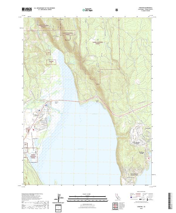
2022 Map of Chester
USGS Topo · Published 2022About this map
Lake Almanor dominates the southern half of this landscape, a massive reservoir shaped by the surrounding volcanic terrain and forest lands. The town of Chester sits at the northwestern edge of the water, where the North Fork Feather River enters the basin. This 2022 survey captures the modern footprint of the area, illustrating the development of lakeside communities like Peninsula Village and the Lake Almanor Country Club on the Almanor Peninsula.
Find a feature on this map
82 named features on this map. Tap any name to fly to it.
Don’t see what you’re looking for? This feature index may not catch every label — zoom into the map to look around manually.
Map Details
Editions of this 2022 Chester Map
This is the sole edition of this map. No revisions or reprints were ever made.
Other maps of this area

1886 · Lassen Peak
USGS Topo · 1:250,000

1892 · Lassen Peak
USGS Topo · 1:250,000

1894 · Lassen Peak
USGS Topo · 1:250,000

1955 · Almanor
USGS Topo · 1:62,500

1955 · Westwood
USGS Topo · 1:250,000

1956 · Mt. Harkness
USGS Topo · 1:62,500

1956 · Chester
USGS Topo · 1:62,500

1958 · Westwood
USGS Topo · 1:250,000

1958 · Jonesville
USGS Topo · 1:62,500

1959 · Westwood
USGS Topo · 1:250,000