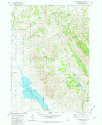
1981 Map of Chesterfield Res
USGS Topo · Published 1982About this map
The eastern reaches of the Fort Hall Indian Reservation dominate this section of Caribou County, where the Old Indian Reservation Boundary cuts through the high desert and mountain landscape. Water management is a primary theme of the terrain, centered on the Chesterfield Reservoir and the Portneuf Canal, which facilitate irrigation for the Portneuf Valley. The hydrological network is dense, featuring numerous seasonal and perennial flows such as Warbonnet Creek, Jeff Cabin Creek River, and Twentyfour Mile Creek.
Find a feature on this map
33 named features on this map. Tap any name to fly to it.
Don’t see what you’re looking for? This feature index may not catch every label — zoom into the map to look around manually.
Map Details
Editions of this 1981 Chesterfield Res Map
This is the sole edition of this map. No revisions or reprints were ever made.
Other maps of this area

1917 · Portneuf
USGS Topo · 1:62,500

1918 · Paradise Valley
USGS Topo · 1:62,500

1954 · Pocatello
USGS Topo · 1:250,000

1955 · Yandell Springs
USGS Topo · 1:62,500

1955 · Idaho Falls
USGS Topo · 1:250,000

1955 · Driggs
USGS Topo · 1:250,000

1955 · Preston
USGS Topo · 1:250,000

1958 · Driggs
USGS Topo · 1:250,000

1958 · Idaho Falls
USGS Topo · 1:250,000

1958 · Pocatello
USGS Topo · 1:250,000