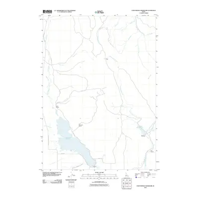
2010 Map of Chesterfield Reservoir
USGS Topo · Published 2010About this map
Chesterfield Reservoir dominates the landscape of this Caribou County region, serving as a primary water management feature fed by the Portneuf River. The map highlights the sophisticated irrigation infrastructure of the early 21st century, including the Toponce and Chesterfield Land Co Ditch and the Portneuf Dam at the reservoir's southern tip. This area is characterized by a network of drainage systems and canyons, with Jim Corneilson Canyon and Pole Canyon cutting through the terrain.
Find a feature on this map
32 named features on this map. Tap any name to fly to it.
Don’t see what you’re looking for? This feature index may not catch every label — zoom into the map to look around manually.
Map Details
Editions of this 2010 Chesterfield Reservoir Map
This is the sole edition of this map. No revisions or reprints were ever made.
Other maps of this area

1917 · Portneuf
USGS Topo · 1:62,500

1918 · Paradise Valley
USGS Topo · 1:62,500

1954 · Pocatello
USGS Topo · 1:250,000

1955 · Yandell Springs
USGS Topo · 1:62,500

1955 · Idaho Falls
USGS Topo · 1:250,000

1955 · Driggs
USGS Topo · 1:250,000

1955 · Preston
USGS Topo · 1:250,000

1958 · Driggs
USGS Topo · 1:250,000

1958 · Idaho Falls
USGS Topo · 1:250,000

1958 · Pocatello
USGS Topo · 1:250,000