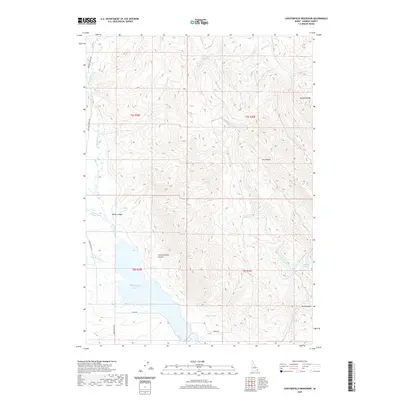
2020 Map of Chesterfield Reservoir
USGS Topo · Published 2020About this map
Chesterfield Reservoir anchors the southwestern portion of this Caribou County landscape, where the waters of Fourth of July Cr and Rock Cr collect in the basin. The terrain is defined by a series of steep drainages and ridges, including the prominent Sawmill Ridge to the northeast and the deep cuts of Jim Corneilson Canyon and Rocky Canyon. The drainage pattern reflects a complex hydrological network feeding into the Portneuf River, which winds along the western edge of the survey area. Several high-elevation water sources such as Cold Spring, Hibner Spring, and Corduroy Spring are noted throughout the hills. The human footprint is most visible through the grid of the Public Land Survey System, with roads like Basin Rd and Banks Rd providing access to the reservoir's shoreline and the surrounding ranching or grazing lands.
Find a feature on this map
32 named features on this map. Tap any name to fly to it.
Don’t see what you’re looking for? This feature index may not catch every label — zoom into the map to look around manually.
Map Details
Editions of this 2020 Chesterfield Reservoir Map
This is the sole edition of this map. No revisions or reprints were ever made.
Other maps of this area

1917 · Portneuf
USGS Topo · 1:62,500

1918 · Paradise Valley
USGS Topo · 1:62,500

1954 · Pocatello
USGS Topo · 1:250,000

1955 · Yandell Springs
USGS Topo · 1:62,500

1955 · Idaho Falls
USGS Topo · 1:250,000

1955 · Driggs
USGS Topo · 1:250,000

1955 · Preston
USGS Topo · 1:250,000

1958 · Driggs
USGS Topo · 1:250,000

1958 · Idaho Falls
USGS Topo · 1:250,000

1958 · Pocatello
USGS Topo · 1:250,000