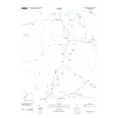
2013 Map of Chestnut Grove
USGS Topo · Published 2013About this map
The Buffalo River anchors this central Perry County landscape, carving a deep, winding path through a series of dramatic hollows and ridges. In this 2012 snapshot of rural Tennessee, the settlement patterns follow the river and its many tributaries, with Beardstown and Chestnut Grove serving as primary local hubs. The terrain is defined by family-named landmarks and geographic features such as Scaggs Bluff and Burns Ridge, alongside a multitude of narrow valleys including Loveless Hollow, Shelton Hollow, and Kittrell Hollow.
Find a feature on this map
94 named features on this map. Tap any name to fly to it.
Don’t see what you’re looking for? This feature index may not catch every label — zoom into the map to look around manually.
Map Details
Editions of this 2013 Chestnut Grove Map
This is the sole edition of this map. No revisions or reprints were ever made.
Other maps of this area

1936 · Graves Spring
USGS Topo · 1:24,000

1936 · Pleasantville
USGS Topo · 1:24,000

1936 · Coble
USGS Topo · 1:24,000

1936 · Pine View
USGS Topo · 1:24,000

1936 · Daniels Landing
USGS Topo · 1:24,000

1936 · Linden
USGS Topo · 1:24,000

1936 · Chestnut Grove
USGS Topo · 1:24,000

1936 · Lobelville
USGS Topo · 1:24,000

1936 · Pope
USGS Topo · 1:24,000
1949 · Pope
USGS Topo · 1:24,000