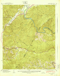
1940 Map of Chestoa
USGS Topo · Published 1940About this map
The Nolichucky River carves a deep path through the Unaka Mountains in this 1939 field survey, marking the rugged border between Tennessee and North Carolina. The Clinchfield RR follows the river's tight curves, serving small mountain settlements and whistle-stops like Love Station, Riverview, and Unaka Springs. High above the water, the Appalachian Trail traverses ridges such as Nobusiness Ridge and Poplar Ridge, passing landmark lookouts like the Temple Hill Lookout Tower. Local life in these gaps and hollows was anchored by scattered institutions including Shallowford Ch and Mountainview Sch. The map documents the transition between the Cherokee National Forest and Pisgah National Forest, illustrating a landscape defined by timber, steep terrain, and the vital rail corridor connecting the valleys.
Find a feature on this map
101 named features on this map. Tap any name to fly to it.
Don’t see what you’re looking for? This feature index may not catch every label — zoom into the map to look around manually.
Map Details
Editions of this 1940 Chestoa Map
This is the sole edition of this map. No revisions or reprints were ever made.
Other maps of this area

1891 · Roan Mountain
USGS Topo · 1:125,000

1892 · Greeneville
USGS Topo · 1:125,000

1894 · Asheville
USGS Topo · 1:125,000

1894 · Roan Mountain
USGS Topo · 1:125,000

1896 · Greeneville
USGS Topo · 1:125,000

1900 · Mount Mitchell
USGS Topo · 1:125,000

1901 · Asheville
USGS Topo · 1:125,000

1902 · Mount Mitchell
USGS Topo · 1:125,000

1904 · Roan Mountain
USGS Topo · 1:125,000

1904 · Greeneville
USGS Topo · 1:125,000