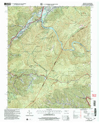
2003 Map of Chestoa
USGS Topo · Published 2004About this map
The Nolichucky River carves a deep path through the mountains at the Tennessee and North Carolina border, defining the rugged geography of the Cherokee National Forest and Pisgah National Forest. Along its banks, the Clinchfield RR follows the river's winding course, connecting small riverside communities like Chestoa and Unaka Springs. The map reveals a landscape of isolated mountain settlements and family landmarks such as Ephraim Place and Cane Bottom, alongside established community hubs including Temple Hill Sch and Shallowford Ch. The Appalachian Trail traverses the high ridges of the Unaka Mountains, crossing several notable gaps. The distribution of small mountain schools like Little Creek Sch and Mountainview Sch reflects the historic settlement patterns of these high-elevation valleys and ridges just after the turn of the millennium.
Find a feature on this map
75 named features on this map. Tap any name to fly to it.
Don’t see what you’re looking for? This feature index may not catch every label — zoom into the map to look around manually.
Map Details
Editions of this 2003 Chestoa Map
This is the sole edition of this map. No revisions or reprints were ever made.
Other maps of this area

1891 · Roan Mountain
USGS Topo · 1:125,000

1892 · Greeneville
USGS Topo · 1:125,000

1894 · Asheville
USGS Topo · 1:125,000

1894 · Roan Mountain
USGS Topo · 1:125,000

1896 · Greeneville
USGS Topo · 1:125,000

1900 · Mount Mitchell
USGS Topo · 1:125,000

1901 · Asheville
USGS Topo · 1:125,000

1902 · Mount Mitchell
USGS Topo · 1:125,000

1904 · Roan Mountain
USGS Topo · 1:125,000

1904 · Greeneville
USGS Topo · 1:125,000