
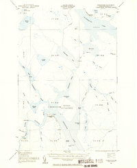
1954 Map of Chesuncook
USGS Topo · Published 1955About this map
Chesuncook Village sits at the heart of this mid-century wilderness survey, serving as a rare point of settlement along the vast expanse of Chesuncook Lake. The landscape is dominated by an intricate network of waterways, including the Penobscot River and (Chesuncook) State Game Refuge on Gero Island. This 1950s record documents the region before significant modern development, showing the connectivity between large bodies of water like Chamberlain Lake and smaller, remote ponds such as Umbazooksus Lake.
Find a feature on this map
69 named features on this map. Tap any name to fly to it.
Don’t see what you’re looking for? This feature index may not catch every label — zoom into the map to look around manually.
Map Details
Editions of this 1954 Chesuncook Map
2 editions found
Other maps of this area

1953 · Telos Lake
USGS Topo · 1:62,500

1954 · North East Carry
USGS Topo · 1:62,500

1954 · Spider Lake
USGS Topo · 1:62,500

1954 · Caucomgomoc Lake
USGS Topo · 1:62,500

1954 · Churchill Lake
USGS Topo · 1:62,500

1954 · Allagash Lake
USGS Topo · 1:62,500

1954 · Grant Farm
USGS Topo · 1:62,500

1954 · Harrington Lake
USGS Topo · 1:62,500

1954 · Presque Isle
USGS Topo · 1:250,000

1954 · Millinocket
USGS Topo · 1:250,000