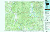
1984 Map of Chewelah
USGS Topo · Published 1984About this map
Chewelah and the surrounding valley of the Colville River define the western portion of this 1984 survey, where the Burlington Northern railroad links several established settlements. The landscape transitions from the agricultural Long Prairie to the resource-rich Huckleberry Mountains, where historical extraction is evidenced by the Alice Mine, Copper King Mine, and Keystone Mine. This region in the mid-1980s reveals a balanced economy of timber, mining, and lakeside recreation.
Find a feature on this map
90 named features on this map. Tap any name to fly to it.
Don’t see what you’re looking for? This feature index may not catch every label — zoom into the map to look around manually.
Map Details
Editions of this 1984 Chewelah Map
This is the sole edition of this map. No revisions or reprints were ever made.
Other maps of this area

1901 · Sandpoint
USGS Topo · 1:125,000

1901 · Spokane
USGS Topo · 1:125,000

1903 · Rathdrum
USGS Topo · 1:125,000

1911 · Priest Lake
USGS Topo · 1:250,000

1911 · Sandpoint
USGS Topo · 1:125,000

1913 · Priest Lake
USGS Topo · 1:250,000

1927 · Chewelah
USGS Topo · 1:125,000

1929 · Colville
USGS Topo · 1:125,000

1930 · Chewelah
USGS Topo · 1:125,000

1933 · Colville
USGS Topo · 1:125,000