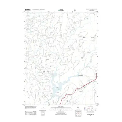
2012 Map of Chicago Park
USGS Topo · Published 2012About this map
You Bet and Red Dog stand as prominent landmarks in this section of the Sierra Nevada foothills, representing the deep mining and pioneer heritage of Nevada County. The terrain is defined by the steep descent toward the Bear River, where the Rollins Reservoir now fills the canyon. The map documents a complex network of historical transportation routes, including the Old Emigrant Trl and Old Donner Trl, which wind through the ridges near Hawkins Canyon. To the south, the infrastructure of the Railroad Rd skirts the edge of Secret Town and Magra, tracing the path of the transcontinental rail corridor. This 2012 survey captures the transition from historic hydraulic mining sites like Chalk Bluff to modern recreation and residential pockets such as Chicago Park and Peardale, showing how the land has been reshaped by both industry and the preservation of mountain travel ways.
Find a feature on this map
52 named features on this map. Tap any name to fly to it.
Don’t see what you’re looking for? This feature index may not catch every label — zoom into the map to look around manually.
Map Details
Editions of this 2012 Chicago Park Map
This is the sole edition of this map. No revisions or reprints were ever made.
Other maps of this area

1888 · Smartsville
USGS Topo · 1:125,000

1891 · Colfax
USGS Topo · 1:125,000

1891 · Smartsville
USGS Topo · 1:125,000

1892 · Smartsville
USGS Topo · 1:125,000

1892 · Colfax
USGS Topo · 1:125,000

1894 · Colfax
USGS Topo · 1:125,000

1894 · Smartsville
USGS Topo · 1:125,000

1895 · Smartsville
USGS Topo · 1:125,000

1898 · Colfax
USGS Topo · 1:125,000

1900 · Colfax
USGS Topo · 1:125,000