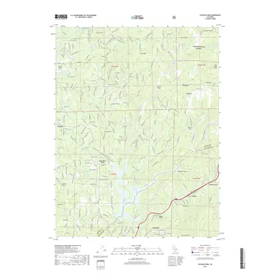
2018 Map of Chicago Park
USGS Topo · Published 2018About this map
You Bet and Red Dog stand as notable historical markers on this landscape, representing the enduring legacy of hydraulic mining and settlement in the Sierra Nevada foothills. The terrain is deeply incised by watercourses like Greenhorn Creek and Steephollow Creek, which carved canyons such as Missouri Canyon and Hawkins Canyon. The infrastructure of the region is defined by water management and transport, visible in the Chicago Park Ditch and the Loma Rica Siphon, which serve the agricultural and residential needs of communities like Chicago Park and Peardale.
Find a feature on this map
239 named features on this map. Tap any name to fly to it.
Don’t see what you’re looking for? This feature index may not catch every label — zoom into the map to look around manually.
Map Details
Editions of this 2018 Chicago Park Map
This is the sole edition of this map. No revisions or reprints were ever made.
Other maps of this area

1888 · Smartsville
USGS Topo · 1:125,000

1891 · Colfax
USGS Topo · 1:125,000

1891 · Smartsville
USGS Topo · 1:125,000

1892 · Smartsville
USGS Topo · 1:125,000

1892 · Colfax
USGS Topo · 1:125,000

1894 · Colfax
USGS Topo · 1:125,000

1894 · Smartsville
USGS Topo · 1:125,000

1895 · Smartsville
USGS Topo · 1:125,000

1898 · Colfax
USGS Topo · 1:125,000

1900 · Colfax
USGS Topo · 1:125,000