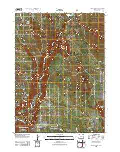
2012 Map of Chicken Hills
USGS Topo · Published 2012About this map
Pleasant Valley anchors the southern portion of this Klamath County landscape, situated near the intersection of Dorris Rd and Old State Hwy. The Klamath River carves a significant course through the center of the quadrangle, including the dramatic sharp bends at Long Point and Big Bend before entering Klamath Canyon. To the north, the river is impounded at the John C Boyle Reservoir, while the surrounding terrain is defined by prominent volcanic features and high-altitude plateaus.
Find a feature on this map
25 named features on this map. Tap any name to fly to it.
Don’t see what you’re looking for? This feature index may not catch every label — zoom into the map to look around manually.
Map Details
Editions of this 2012 Chicken Hills Map
This is the sole edition of this map. No revisions or reprints were ever made.
Other maps of this area

1886 · Modoc Lava Bed
USGS Topo · 1:250,000

1886 · Shasta
USGS Topo · 1:250,000

1889 · Klamath
USGS Topo · 1:250,000

1891 · Ashland
USGS Topo · 1:250,000

1892 · Modoc Lava-Bed
USGS Topo · 1:250,000

1893 · Ashland
USGS Topo · 1:250,000

1894 · Klamath
USGS Topo · 1:250,000

1894 · Shasta
USGS Topo · 1:250,000

1897 · Ashland
USGS Topo · 1:250,000

1934 · Macdoel
USGS Topo · 1:96,000