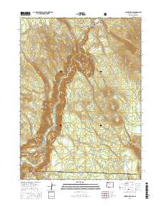
2017 Map of Chicken Hills
USGS Topo · Published 2017About this map
Klamath Canyon and the Klamath River anchor the southwestern corner of this survey, where the river carves through the high plateau at the Oregon-California border. The landscape is dominated by volcanic features and timbered slopes, including the prominent Chicken Hills and the massive Hayden Mtn to the north. Industry in this high-desert forest is represented by the Slipeasy Quarry, while historical movement through the region is traced by the winding Topsy Grade Rd, an old freight route that climbs out of the canyon. To the north, the John C Boyle Reservoir breaks the dry terrain, which is otherwise punctuated by high-elevation landmarks like Grizzly Butte and the wide meadows of Bear Flat. The map highlights the complex boundaries between Klamath National Forest and private holdings, showing a network of logging roads like Slip Easy Rd and Sec 1 Access Rd that define the modern forest economy.
Find a feature on this map
43 named features on this map. Tap any name to fly to it.
Don’t see what you’re looking for? This feature index may not catch every label — zoom into the map to look around manually.
Map Details
Editions of this 2017 Chicken Hills Map
This is the sole edition of this map. No revisions or reprints were ever made.
Other maps of this area

1886 · Modoc Lava Bed
USGS Topo · 1:250,000

1886 · Shasta
USGS Topo · 1:250,000

1889 · Klamath
USGS Topo · 1:250,000

1891 · Ashland
USGS Topo · 1:250,000

1892 · Modoc Lava-Bed
USGS Topo · 1:250,000

1893 · Ashland
USGS Topo · 1:250,000

1894 · Klamath
USGS Topo · 1:250,000

1894 · Shasta
USGS Topo · 1:250,000

1897 · Ashland
USGS Topo · 1:250,000

1934 · Macdoel
USGS Topo · 1:96,000