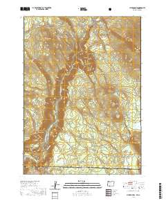
2020 Map of Chicken Hills
USGS Topo · Published 2020About this map
The Klamath Wild and Scenic River carves a deep path through this borderland region where Klamath County, Oregon, meets Siskiyou County, California. The landscape is defined by significant volcanic and tectonic features, from the heights of Hayden Mountain Summit and Chase Mtn to the depths of Klamath Canyon. Settlement is sparse, with the location of Hadwick and the open ground of Randolph Flats serving as primary landmarks for local history researchers. A network of timber and access roads, such as Topsy Grade Rd and Slip Easy Rd, crisscross the terrain, reflecting the region's relationship with the Klamath National Forest. Industrial activity is noted at the Slipeasy Quarry, while natural water features like Fox Lake and Hayden Cr provide essential drainage for the high-elevation flats and ridges.
Find a feature on this map
51 named features on this map. Tap any name to fly to it.
Don’t see what you’re looking for? This feature index may not catch every label — zoom into the map to look around manually.
Map Details
Editions of this 2020 Chicken Hills Map
This is the sole edition of this map. No revisions or reprints were ever made.
Other maps of this area

1886 · Modoc Lava Bed
USGS Topo · 1:250,000

1886 · Shasta
USGS Topo · 1:250,000

1889 · Klamath
USGS Topo · 1:250,000

1891 · Ashland
USGS Topo · 1:250,000

1892 · Modoc Lava-Bed
USGS Topo · 1:250,000

1893 · Ashland
USGS Topo · 1:250,000

1894 · Klamath
USGS Topo · 1:250,000

1894 · Shasta
USGS Topo · 1:250,000

1897 · Ashland
USGS Topo · 1:250,000

1934 · Macdoel
USGS Topo · 1:96,000