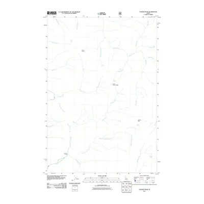
2011 Map of Chicken Peak
USGS Topo · Published 2011About this map
South Fork Salmon River anchors the southwestern portion of this 2011 survey, a landscape defined by sharp elevation changes and high-country springs in Idaho County. The terrain rises toward Chicken Peak and the evocative Horse Heaven Ridge, revealing a drainage network where multiple creeks, such as Chicken Creek and North Fork Porphyry Creek, converge toward the river system. This map is particularly valuable for its documentation of vital backcountry water sources, including Chicken Spring, Soldier Spring, and Mosquito Springs. Traceable infrastructure is limited in this area, with the Porphyry Bridge serving as a significant crossing point near the river's bend. The inclusion of Spring Camp and Horse Heaven provides insight into the naming conventions and localized landmarks used by those navigating this remote Idaho interior.
Find a feature on this map
27 named features on this map. Tap any name to fly to it.
Don’t see what you’re looking for? This feature index may not catch every label — zoom into the map to look around manually.
Map Details
Editions of this 2011 Chicken Peak Map
This is the sole edition of this map. No revisions or reprints were ever made.
Other maps of this area

1937 · Big Creek
USGS Topo · 1:48,000

1942 · Big Creek
USGS Topo · 1:62,500

1956 · Warren
USGS Topo · 1:62,500

1956 · Elk City
USGS Topo · 1:250,000

1960 · Elk City
USGS Topo · 1:250,000

1969 · Wolf Fang Peak
USGS Topo · 1:24,000

1969 · Big Creek
USGS Topo · 1:24,000

1969 · Pilot Peak
USGS Topo · 1:24,000

1978 · Mosquito Peak
USGS Topo · 1:24,000

1978 · Chicken Peak
USGS Topo · 1:24,000