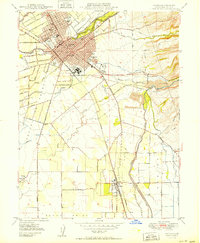
1950 Map of Chico
USGS Topo · Published 1950About this map
State College and the industrial activity of the Diamond Match Factory anchor the growing community of Chico in the late 1940s. The map reveals a landscape defined by water management and transit, where the Southern Pacific railroad cuts a diagonal path through the city and south past Barber and Stirling Junction. Beyond the urban core, the terrain transitions into the agricultural and riparian corridors of Butte Creek and Big Chico Creek, with large swaths of land dedicated to the Bidwell Park and specialized federal sites like the U.S. Dept of Agriculture Plant Introduction Garden.
Find a feature on this map
39 named features on this map. Tap any name to fly to it.
Don’t see what you’re looking for? This feature index may not catch every label — zoom into the map to look around manually.
Map Details
Editions of this 1950 Chico Map
2 editions found
Other maps of this area

1891 · Chico
USGS Topo · 1:125,000

1893 · Chico
USGS Topo · 1:125,000

1895 · Chico
USGS Topo · 1:125,000

1912 · Dry Creek
USGS Topo · 1:31,680

1912 · Durham
USGS Topo · 1:31,680

1912 · Nord
USGS Topo · 1:31,680

1912 · Chico Landing
USGS Topo · 1:31,680

1912 · Nelson
USGS Topo · 1:31,680

1912 · Keefers
USGS Topo · 1:31,680

1912 · Clear Creek
USGS Topo · 1:31,680