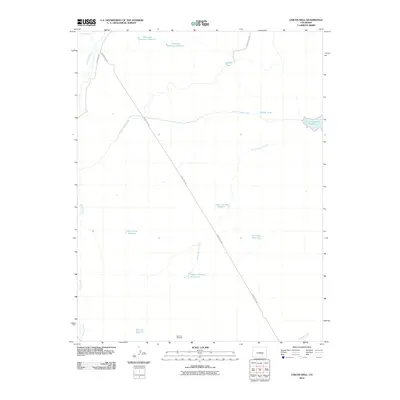
2010 Map of Chicos Well
USGS Topo · Published 2010About this map
Water management and ranching infrastructure define this arid landscape in eastern Pueblo County, where the Huerfano River cuts through the northwest corner. A sophisticated network of irrigation and storage is evident, anchored by the long reach of the Nepesta Farmers Ditch and a series of vital catchment points including the Upper Chicosa Reservoir, Lower Chicosa Reservoir, and West Chicos Reservoir. This concentration of reservoirs suggests a landscape deeply shaped by the necessity of water storage for agricultural or livestock use.
Find a feature on this map
20 named features on this map. Tap any name to fly to it.
Don’t see what you’re looking for? This feature index may not catch every label — zoom into the map to look around manually.
Map Details
Editions of this 2010 Chicos Well Map
This is the sole edition of this map. No revisions or reprints were ever made.
Other maps of this area

1891 · Nepesta
USGS Topo · 1:125,000

1891 · Apishapa
USGS Topo · 1:125,000

1893 · Nepesta
USGS Topo · 1:125,000

1893 · Apishapa
USGS Topo · 1:125,000

1897 · Apishapa
USGS Topo · 1:125,000

1904 · Nepesta
USGS Topo · 1:125,000

1954 · Trinidad
USGS Topo · 1:250,000

1954 · Pueblo
USGS Topo · 1:250,000

1955 · Trinidad
USGS Topo · 1:250,000

1957 · Pueblo
USGS Topo · 1:250,000