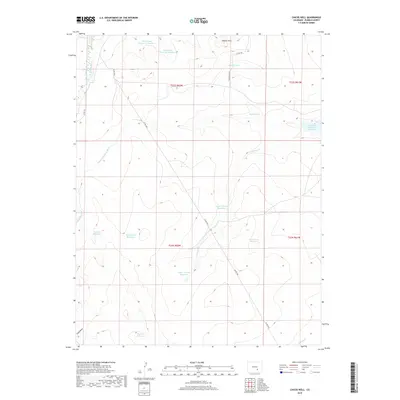
2019 Map of Chicos Well
USGS Topo · Published 2019About this map
Huerfano River drainage and a complex system of irrigation infrastructure define this corner of Pueblo County in the late 2010s. The landscape is marked by a sophisticated network of water management, evidenced by the Nepesta Farmers Ditch and Welton Ditch that traverse the western edge. These channels support numerous named catchments, from the larger Nepesta Reservoir Number 5 to the multi-part Upper Chicosa Reservoir and Lower Chicosa Reservoir. In the north, the Hooker Hills provide topographic relief, while the McFarland Reservoir Number 1 and McFarland Reservoir Number 2 underscore the agricultural priority of this arid terrain. Remote county roads, including Hookerhills Rd and Co Rd 3702, offer the primary access through this sparsely settled territory.
Find a feature on this map
28 named features on this map. Tap any name to fly to it.
Don’t see what you’re looking for? This feature index may not catch every label — zoom into the map to look around manually.
Map Details
Editions of this 2019 Chicos Well Map
This is the sole edition of this map. No revisions or reprints were ever made.
Other maps of this area

1891 · Nepesta
USGS Topo · 1:125,000

1891 · Apishapa
USGS Topo · 1:125,000

1893 · Nepesta
USGS Topo · 1:125,000

1893 · Apishapa
USGS Topo · 1:125,000

1897 · Apishapa
USGS Topo · 1:125,000

1904 · Nepesta
USGS Topo · 1:125,000

1954 · Trinidad
USGS Topo · 1:250,000

1954 · Pueblo
USGS Topo · 1:250,000

1955 · Trinidad
USGS Topo · 1:250,000

1957 · Pueblo
USGS Topo · 1:250,000