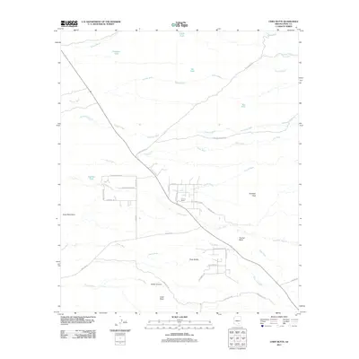
2011 Map of Chief Butte
USGS Topo · Published 2011About this map
Forman Ranch sits at the heart of this Pinal County landscape, where an intricate network of desert washes and watering tanks supports local ranching. The terrain is defined by prominent igneous landmarks, including Antelope Peak, Panther Butte, and Three Buttes, which rise above the surrounding alluvial plains. A series of seasonal drainage systems, such as Durham Wash and Coronado Wash, carve through the earth, leading toward the Suizo Mountains in the southwest. The presence of water infrastructure like Cadillac Tank and Freeman Tank underscores the necessity of water management in this arid environment. Roads like Goff Ranch Rd and Park Link Dr provide access through the shifting elevations of Parker Canyon and toward the namesake Chief Butte at the southern edge of the survey.
Find a feature on this map
42 named features on this map. Tap any name to fly to it.
Don’t see what you’re looking for? This feature index may not catch every label — zoom into the map to look around manually.
Map Details
Editions of this 2011 Chief Butte Map
This is the sole edition of this map. No revisions or reprints were ever made.
Other maps of this area

1911 · Winkelman
USGS Topo · 1:125,000

1913 · Winkelman
USGS Topo · 1:125,000

1934 · Newman Peak
USGS Topo · 1:125,000

1949 · Winkelman
USGS Topo · 1:62,500

1949 · Black Mountain
USGS Topo · 1:24,000
1950 · Black Mountain
USGS Topo · 1:24,000
1951 · Winkelman
USGS Topo · 1:62,500

1956 · Tucson
USGS Topo · 1:250,000

1958 · Tucson
USGS Topo · 1:250,000

1959 · Tucson
USGS Topo · 1:250,000