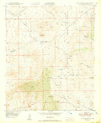
1950 Map of Black Mountain
USGS Topo · Published 1950About this map
Black Mountain and the Tortilla Mountains define this high-desert territory in Pinal County at the mid-century. The landscape is characterized by a network of seasonal watercourses like Lambing Wash, Cottonwood Wash, and Bloodsucker Wash, which shaped the placement of early ranching outposts and infrastructure. Several former habitations are noted as sites, including Barkerville (Site), Rincon Ranch (Site), and Old Finch Ranch (Site), indicating a shift in the local settlement pattern.
Find a feature on this map
38 named features on this map. Tap any name to fly to it.
Don’t see what you’re looking for? This feature index may not catch every label — zoom into the map to look around manually.
Map Details
Editions of this 1950 Black Mountain Map
This is the sole edition of this map. No revisions or reprints were ever made.
Other maps of this area

1911 · Winkelman
USGS Topo · 1:125,000

1913 · Winkelman
USGS Topo · 1:125,000

1934 · Newman Peak
USGS Topo · 1:125,000

1949 · Crozier Peak
USGS Topo · 1:24,000

1949 · Winkelman
USGS Topo · 1:24,000

1949 · Winkelman
USGS Topo · 1:62,500

1949 · Black Mountain
USGS Topo · 1:24,000
1949 · Putnam Wash
USGS Topo · 1:24,000
1950 · Crozier Peak
USGS Topo · 1:24,000
1950 · Putnam Wash
USGS Topo · 1:24,000