
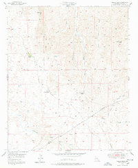
1949 Map of Crozier Peak
USGS Topo · Published 1955About this map
Silver Queen Mine and the Grand Prize Mine highlight the mineral extraction history of this Pinal County landscape at the end of the 1940s. The terrain is defined by a series of drainages, most notably Ripsey Wash, Cottonwood Wash, and Eagle Wash, which carve through the high ground surrounding Crozier Peak and Ripsey Hill.
Find a feature on this map
21 named features on this map. Tap any name to fly to it.
Don’t see what you’re looking for? This feature index may not catch every label — zoom into the map to look around manually.
Map Details
Editions of this 1949 Crozier Peak Map
2 editions found
Other maps of this area

1900 · Florence
USGS Topo · 1:125,000

1902 · Florence
USGS Topo · 1:125,000

1910 · Ray
USGS Topo · 1:62,500

1911 · Winkelman
USGS Topo · 1:125,000

1913 · Winkelman
USGS Topo · 1:125,000

1934 · Newman Peak
USGS Topo · 1:125,000

1949 · Winkelman
USGS Topo · 1:24,000

1949 · Winkelman
USGS Topo · 1:62,500

1949 · Black Mountain
USGS Topo · 1:24,000
1949 · Putnam Wash
USGS Topo · 1:24,000