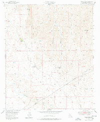
1949 Map of Crozier Peak
USGS Topo · Published 1978About this map
Crozier Peak stands as the dominant topographical feature in this high-desert landscape of Pinal County, surveyed shortly after World War II. The map reveals a remote ranching and mining environment, characterized by isolated outposts like the Tecolote Ranch and the Tony Lopez Ranch. A network of ephemeral drainages, including Ripsey Wash, Eagle Wash, and Hackberry Wash, score the terrain, illustrating the complex watershed system of the Tortilla Mountains. Traces of human industry are evident at the Silver Queen Mine and the Grand Prize Mine, which reflect the region's enduring connection to mineral extraction. Early transportation is marked by the Old Florence Road, while the inclusion of the Ripsey Ranch (Ruins) and a underground pipe line provides a look at the shifting footprint of habitation and infrastructure in this arid corridor.
Find a feature on this map
20 named features on this map. Tap any name to fly to it.
Don’t see what you’re looking for? This feature index may not catch every label — zoom into the map to look around manually.
Map Details
Editions of this 1949 Crozier Peak Map
2 editions found
Other maps of this area

1900 · Florence
USGS Topo · 1:125,000

1902 · Florence
USGS Topo · 1:125,000

1910 · Ray
USGS Topo · 1:62,500

1911 · Winkelman
USGS Topo · 1:125,000

1913 · Winkelman
USGS Topo · 1:125,000

1934 · Newman Peak
USGS Topo · 1:125,000

1949 · Crozier Peak
USGS Topo · 1:24,000

1949 · Winkelman
USGS Topo · 1:24,000

1949 · Winkelman
USGS Topo · 1:62,500

1949 · Black Mountain
USGS Topo · 1:24,000