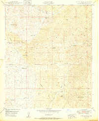
1950 Map of Putnam Wash
USGS Topo · Published 1950About this map
Antelope Peak dominates the northwestern corner of this Pinal County landscape, which in the late 1940s was defined by a sparse network of ranching outposts and vital water sources. The map documents a rugged cattle-country infrastructure where life centered on isolated landmarks like Cactus Hill Ranch and Tunnel Ranch. A complex system of ephemeral drainage ways, including Putnam Wash, Bloodsucker Wash, and Grant Camp Wash, carves through the terrain, punctuated by named wells and tanks that were essential for livestock in this arid environment. Of particular interest to industrial historians is the presence of a Pipe Line and an Underground Pipe Line traversing the central and southern sections, indicating early mid-century utility development. The distribution of features like Yellowjacket Well and Beehive Well provides a detailed look at the rural land use patterns before later regional expansion.
Find a feature on this map
22 named features on this map. Tap any name to fly to it.
Don’t see what you’re looking for? This feature index may not catch every label — zoom into the map to look around manually.
Map Details
Editions of this 1950 Putnam Wash Map
This is the sole edition of this map. No revisions or reprints were ever made.
Other maps of this area

1911 · Winkelman
USGS Topo · 1:125,000

1913 · Winkelman
USGS Topo · 1:125,000

1948 · Mammoth
USGS Topo · 1:62,500

1948 · Mammoth
USGS Topo · 1:24,000

1949 · Mammoth
USGS Topo · 1:24,000

1949 · Holy Joe Peak
USGS Topo · 1:62,500

1949 · Crozier Peak
USGS Topo · 1:24,000

1949 · Winkelman
USGS Topo · 1:24,000

1949 · Winkelman
USGS Topo · 1:62,500

1949 · Saddle Mtn.
USGS Topo · 1:24,000