
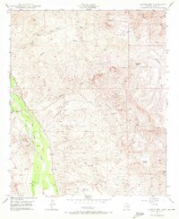
1949 Map of Saddle Mtn.
USGS Topo · Published 1961About this map
The San Pedro River corridor defines the western edge of this 1940s landscape, providing a lush contrast to the surrounding Pinal County desert. This era of land use is clearly visible through the presence of scattered remote outposts such as Kelleys Camp, Eskimazene Ranch, and Whittaker Ranch, which signify the ranching history of the region. Educational life of a previous generation is marked by the Finch Sch (Aban'd), located near Swingle Wash and Narrows Hill.
Find a feature on this map
29 named features on this map. Tap any name to fly to it.
Don’t see what you’re looking for? This feature index may not catch every label — zoom into the map to look around manually.
Map Details
Editions of this 1949 Saddle Mtn. Map
4 editions found
Other maps of this area

1910 · Ray
USGS Topo · 1:62,500

1911 · Winkelman
USGS Topo · 1:125,000

1913 · Winkelman
USGS Topo · 1:125,000

1915 · Christmas
USGS Topo · 1:62,500

1917 · Christmas
USGS Topo · 1:62,500

1949 · Holy Joe Peak
USGS Topo · 1:62,500

1949 · Winkelman
USGS Topo · 1:24,000

1949 · Winkelman
USGS Topo · 1:62,500

1949 · Brandenburg Mtn
USGS Topo · 1:24,000
1949 · Holy Joe Peak
USGS Topo · 1:24,000