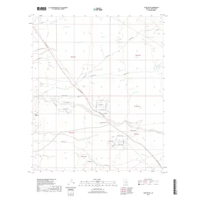
2018 Map of Chief Butte
USGS Topo · Published 2018About this map
Chief Butte and the surrounding Pinal County desert floor appear here in a landscape defined by seasonal drainages and isolated volcanic rises. The terrain is crisscrossed by a network of washes including the significant Durham Wash, Coronado Wash, and Suizo Wash, which descend from the western Suizo Mountains. These watercourses serve as the primary geographical markers in a region where water management is critical, as evidenced by the distribution of local resources like Freeman Tank, Hit Tank, and Cadillac Tank.
Find a feature on this map
53 named features on this map. Tap any name to fly to it.
Don’t see what you’re looking for? This feature index may not catch every label — zoom into the map to look around manually.
Map Details
Editions of this 2018 Chief Butte Map
This is the sole edition of this map. No revisions or reprints were ever made.
Other maps of this area

1911 · Winkelman
USGS Topo · 1:125,000

1913 · Winkelman
USGS Topo · 1:125,000

1934 · Newman Peak
USGS Topo · 1:125,000

1949 · Winkelman
USGS Topo · 1:62,500

1949 · Black Mountain
USGS Topo · 1:24,000
1950 · Black Mountain
USGS Topo · 1:24,000
1951 · Winkelman
USGS Topo · 1:62,500

1956 · Tucson
USGS Topo · 1:250,000

1958 · Tucson
USGS Topo · 1:250,000

1959 · Tucson
USGS Topo · 1:250,000